

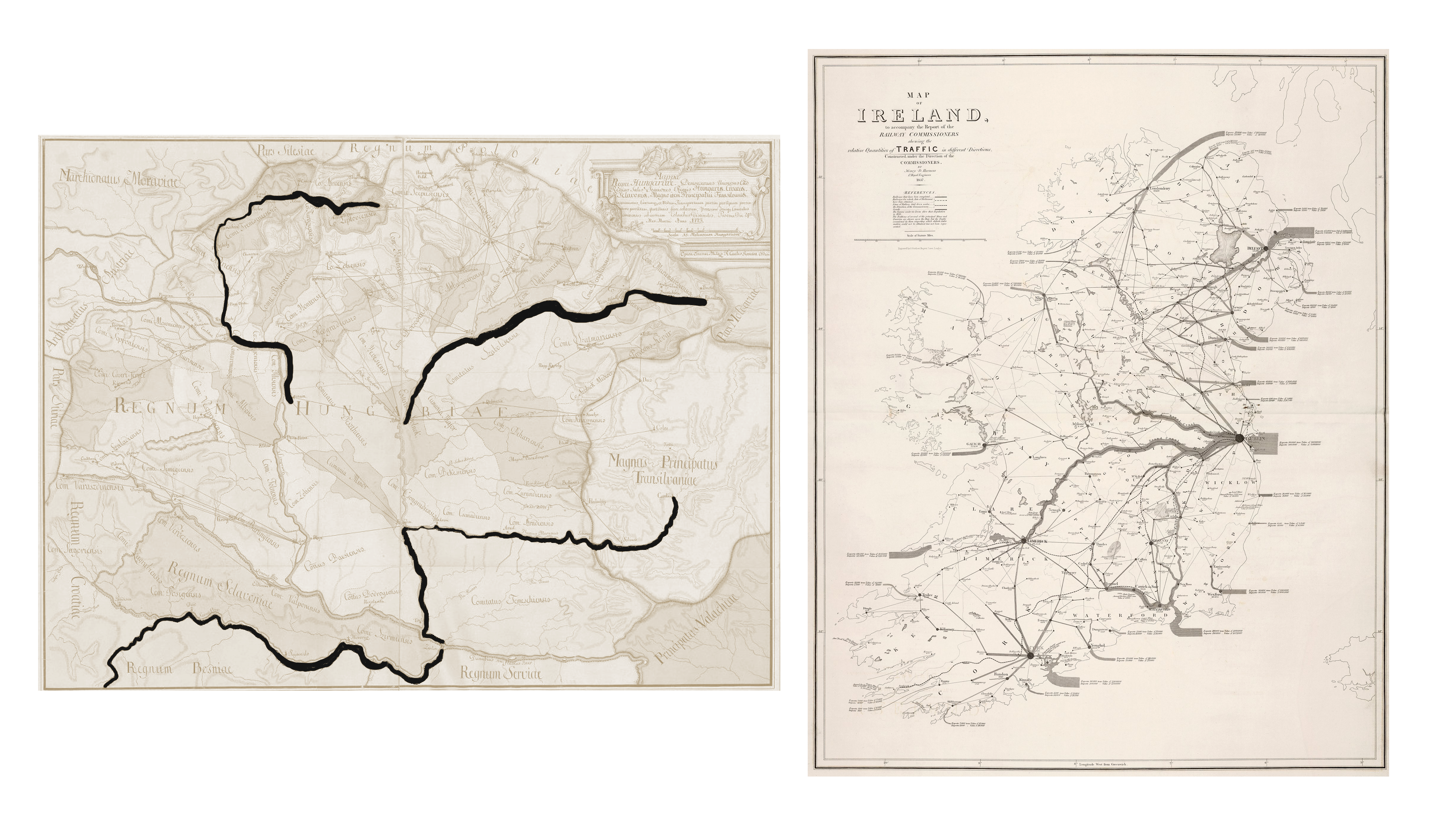
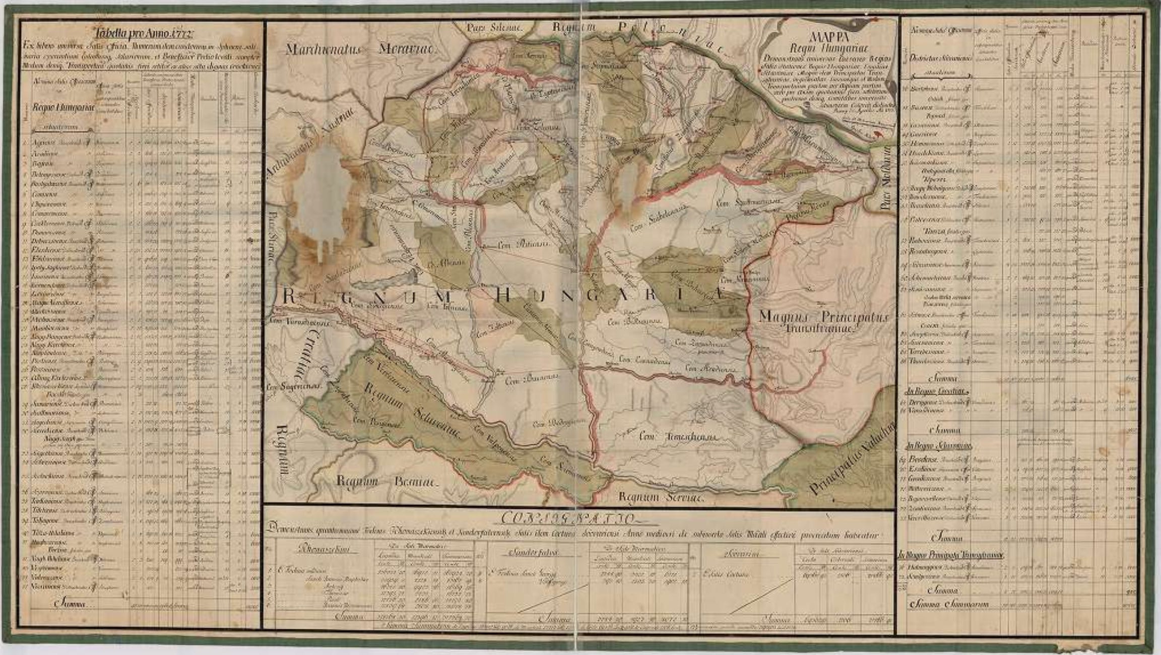
Could this be the first flow map from 1773?
A map showing the volumes of the salt trade of Hungary.

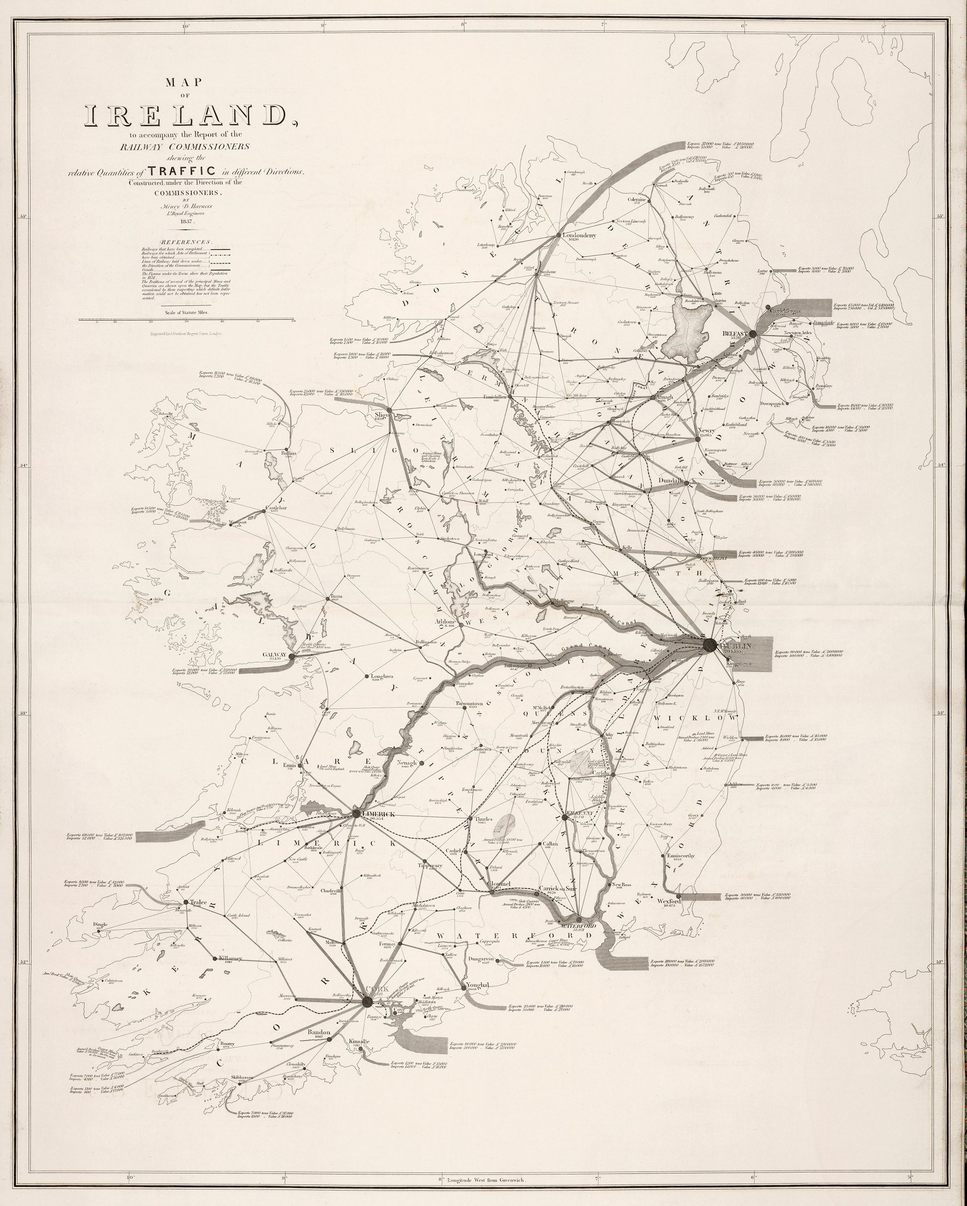
I am sharing a map that I often post on social media, especially when someone attributes the first flow maps to Irishman Henry Drury Harness from 1837. Although Harness considered himself the inventor of the method, despite occasional objections from Hungarian map historians (Árpád Papp-Váry 1990, István Klinghammer 1995), Arthur H. Robinson’s 1955 study has cemented Harness’s primacy. However, there may be a flow map that predates Harness’s map by more than sixty years: Imre Milecz’s 1773 map of the routes and volumes of the salt trade in Hungary.
Little is known about the life of Imre Milecz (sometimes Miletz, Latinized as Emericus, Emerici, Germanized as Emerich, 1738–1800) and his family (his brother? György, Georgius was cartographer too), although he is credited with creating numerous maps, either independently or in collaboration with others. Milecz was a chamber engineer and cartographer, attended the Piarist Collegium Oeconomicum in Szenc (now Senec, Slovakia) and was a student of Sámuel Mikoviny, one of the most important Hungarian mapmaker of the 18th century.
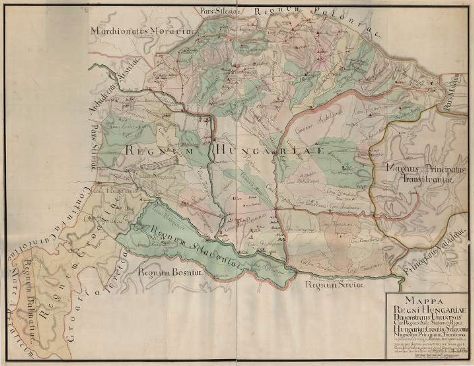
In 1773, Milecz published the hand drawn and coloured Mappa Regni Hungariae demonstrans universas caeo regias salis stationes, Regnis Hungariae, Croatiae, Sclavoniae, Magno item Principatui Transilvaniae ingremiatas (Map of the Kingdom of Hungary showing all the royal salt works stations belonging to the Kingdoms of Hungary, Croatia, and Slavonia, as well as to the Grand Principality of Transylvania) in Pozsony (now Bratislava, Slovakia). In addition to the map, the complete work also includes data on the salt trade in 1772 in tabular form. The Latin cartouche of the map also says that the map shows “rivers, mountains, and roads laid down partly by survey and partly according to itineraries; in which the boundaries of the provinces are shown, and finally the counties are everywhere distinguished by different colours.” The date of publication is “24th day of March, in the year 1773.”

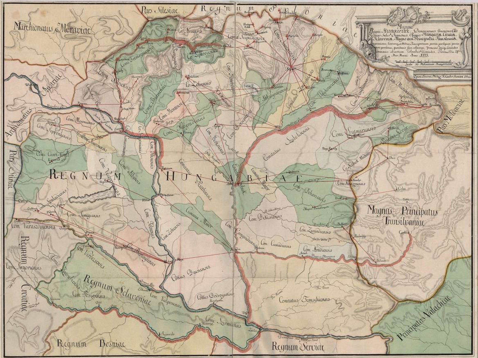
The most interesting part of the map is that it shows the volume of salt trade on each river with stacked lines. The greater the quantity transported on each river section, the more lines he used to indicate it.
The map sections below, from north to south, show the salt trade volumes of the Váh River, the Danube, the upper section of the Tisza, the lower section of the Tisza, the Maros, and the Sava.
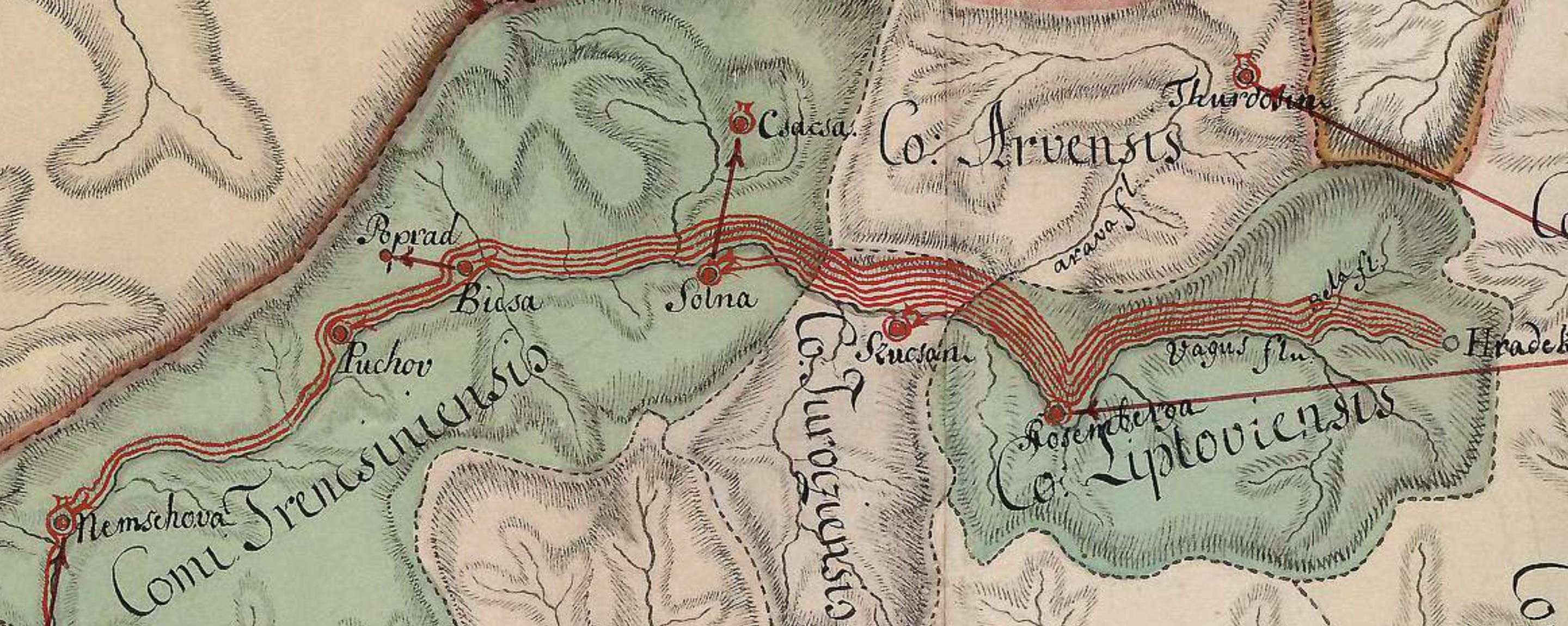
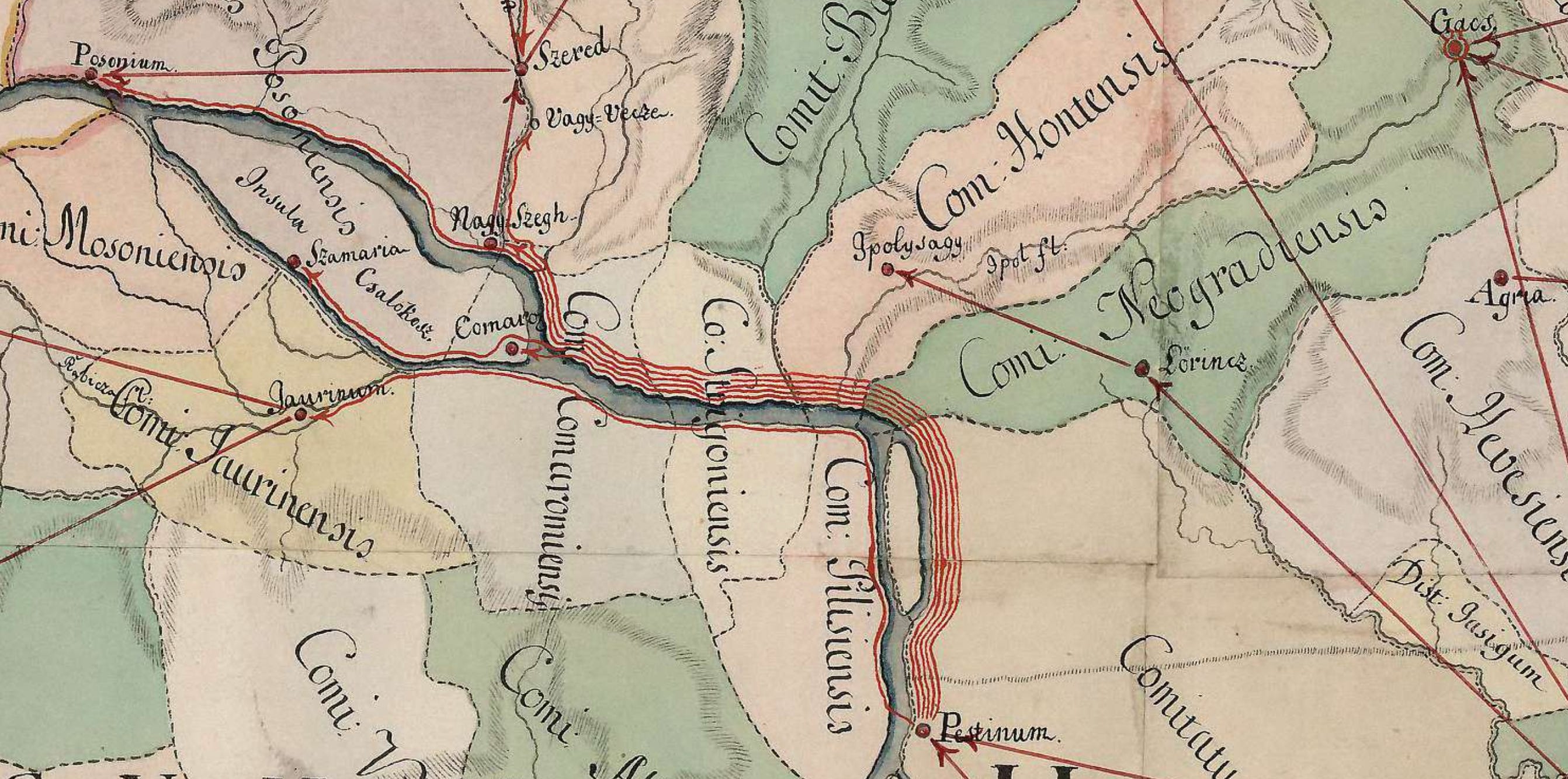
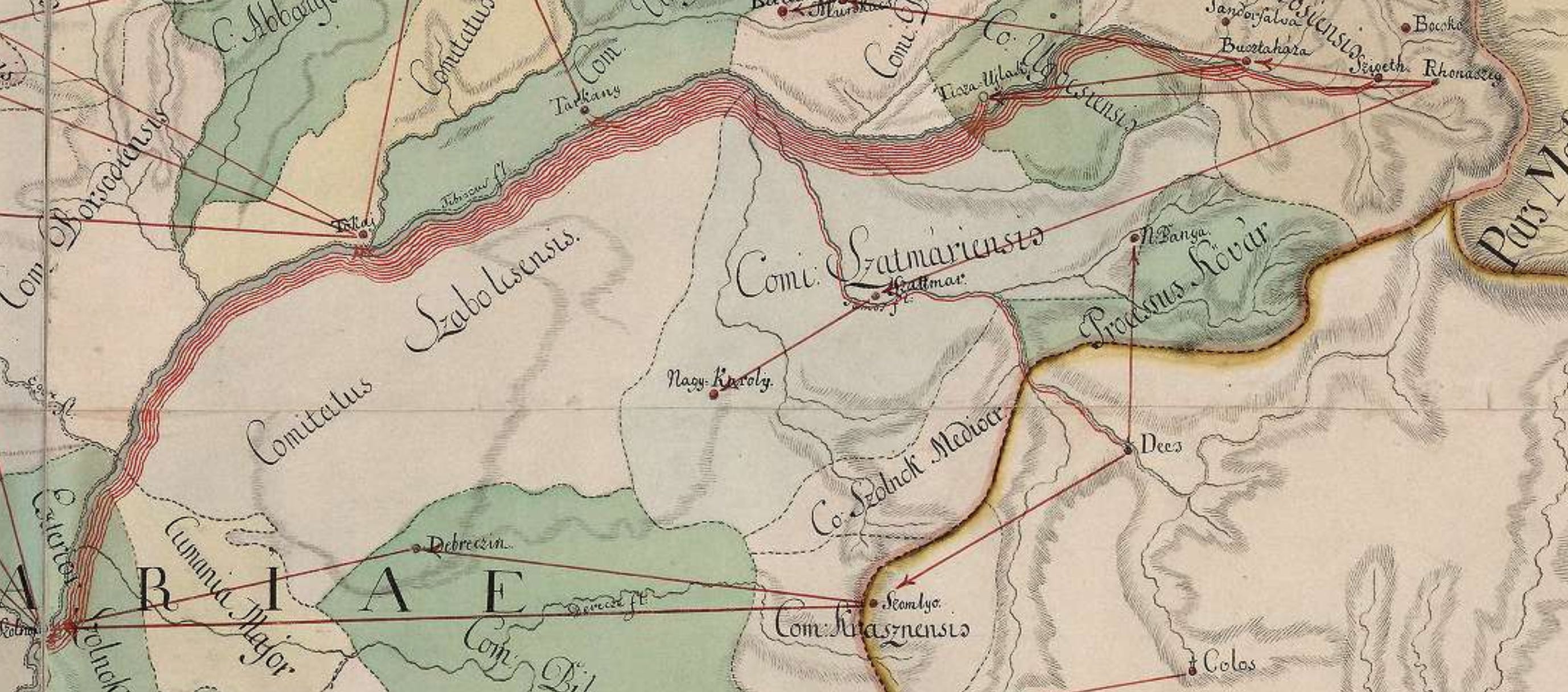
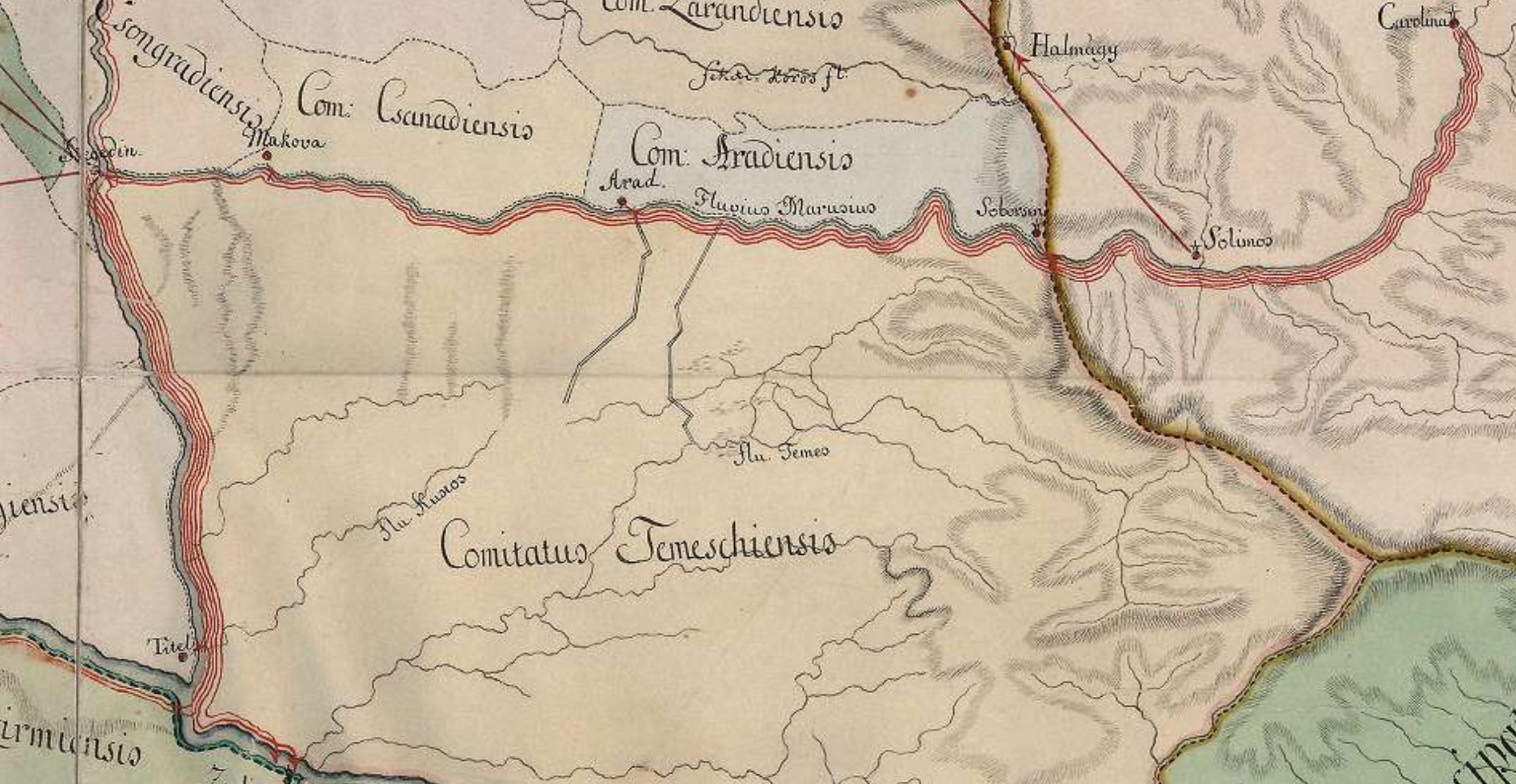
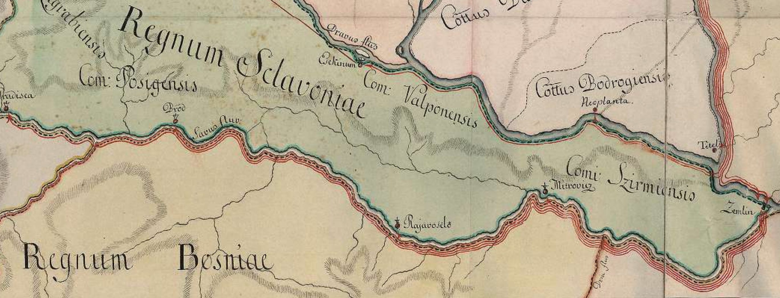
As can be seen, Milecz’s method differs from Harness’s in that Milecz experiments with stacking lines, while Harness uses strips. If Milecz had coloured the space between the outer lines, the end result would have been the same. There will obviously be those who say that the two methods are not the same. There is no record of whether Milecz was aware of the novelty of his method; he makes no mention of it in the map’s cartouche, referring only to routes, itineraries and places.
There are two other versions of Milecz’s map. One was made by Georgius Milecz a month later than the original (which has a date of March, 1773), and the other, with seemingly updated data, was probably made by Imre Milecz himself in 1781.
What have we learned today? One thing is that data graphics can appear at any time that predate what was previously believed to be the first invention. Therefore, we should be much more cautious when using the word “first.” Another is that these innovations in graphic methods do not always come from Western Europe or the US. Scientists, including mathematicians, cartographers, statisticians, economists, all over the world have been concerned with the visual communication of specific problems. It is conceivable that there is an even earlier flow map than Milecz’s.
Other
Last week I wrote a guest post to the Patterns of Translation about visualizing the history of literature. Here you can read the post.


I am definitely one of those that attribute the first flow map to Henry Drury Harness, at least until today. I was certainly not aware of Milecz’s map, but you are totally right: using the adjective “first” is risky when talking about cartography.